Vision
Improve floodplain function for multiple purposes through voluntary collaborative partnerships with private landowners, sovereign tribal entities, government, and non-government representatives.
Working in Concert
This program will work in concert with a constellation of efforts underway in the Colusa, Butte, and Sutter Basins in the Mid-Sacramento River Valley region to improve the floodplain functional connectivity to support salmon, birds, and agriculture.

Priorities
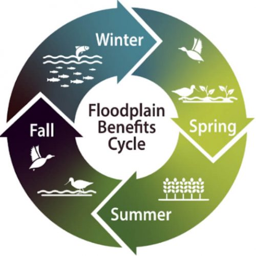
Floodplain functional connectivity complements the multiple priorities including:
Principles
Geographic Region
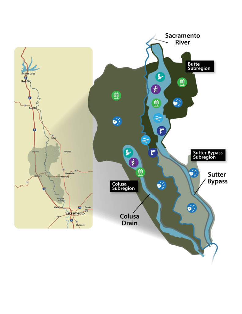
The geographic scope includes the historic floodplain of the Sacramento River from the Butte Sink in the north to the top of the Yolo Bypass in the south. The basins of focus within the historic floodplain are defined by current and potential accessibility by juvenile salmon.
Colusa Subregion
- West of the Sacramento River
- Defining infrastructure: Colusa Basin Drain
- Northern most point: Delevan Wildlife Refuge
- Southernmost point: Yolo Bypass
Butte Subregion
- East of the Sacramento River
- Defining infrastructure: Various diversions east of the Sacramento River and West of Butte Creek
- Northern most point: M&T Ranch
- Southernmost point: Butte Slough Bifurcation
Sutter Bypass Subregion
- East of the Sacramento River
- Defining infrastructure: Sutter Bypass East and West Borrows and adjacent properties
- Southernmost point: Fremont Weir where Sutter Bypass meets the Sacramento River
Geographic Area
Floodplain Benefits – Existing


Phase I: Feasibility Study
RD108 has received a Prop 68 grant from the California Natural Resources Agency for Phase I, which is scheduled for August 2021 – July 2023. In Phase I, in cooperation with landowners the program will evaluate the feasibility of reintroducing low flows during the agricultural off-season, onto lands owned by willing landowners of the Butte Sink, Sutter Bypass and Colusa Basin.
The group will explore the feasibility of combinations of actions to increase floodplain function connectivity, which is reconnecting rivers to their historical floodplains. Potential actions might include modifications to multiple existing weirs, and gated outlet structures and/or construction of new structures, as well as and improving/creating flow conveyance infrastructure needed to reactivate floodplains.
Phase II: Technical Assistance & Science Development
In Phase II, funded by the U.S. Bureau of Reclamation, Floodplains Reimagined will focus on two objectives:
- Continue to provide technical assistance to landowners to consider options to increase floodplain function on their lands;
- Develop and synthesize science that supports development of beneficial options for floodplain management.
Program Partners
Program director and grant recipient
Kjeldsen Sinnock Neudeck (KSN)
Project manager and engineering support
Stakeholder involvement and facilitation services
Process advisors
Hydrologic & hydraulic model development
Technical Team support, salmon benefits model development
Bioenergetics model development
Salmon benefits model development
Aquatic Resources Consulting Scientists
Habitat suitability criteria development
